Sites and portfolios
Site selection, land and property intelligence and cadastral digitisation connect a place to the records behind it.

SERVICES / Location Intelligence
Map your assets, customers and demand together to see where to invest, expand or intervene.
RECOGNISE THE PROBLEM
WHAT THE WORK CAN INCLUDE
Site selection, land and property intelligence and cadastral digitisation connect a place to the records behind it.
Expansion sequences, route planning and operational maps account for proximity and the network already in place.
Remote sensing and conversational GeoAI dashboards make spatial information accessible to the people deciding where to act.
BEFORE THE BUILD
We put the proposed decision on a map. We check coverage, boundaries, coordinate systems and the difference between a point on a screen and a place in the business.
See the FloData MethodFOR THE TECHNICAL EVALUATOR
Illustrative approach. We select the stack after the diagnostic.
RELEVANT WORK
View related work
Scanned property files became a linked register, with every ownership change traced to its source and every plot on the map.
OCR and document classification · Two-pass AI extraction with validation · Chain-of-title register · Web map with plot polygons · Maker, checker and approver workflows
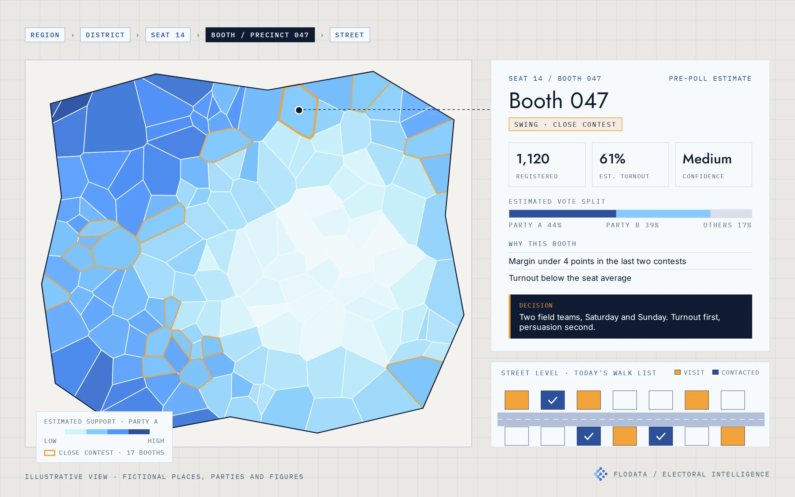
Electoral intelligence for a US campaign and an Indian party organisation. Estimates built from official results, mapped from the seat to the street.
Official results and electoral rolls from public sources · Booth reconciliation across elections · Segment-level turnout and preference model · Bottom-up aggregation with confidence levels · Web maps from region to household · Prediction service with Excel-ready exports · Web dashboard and mobile field app
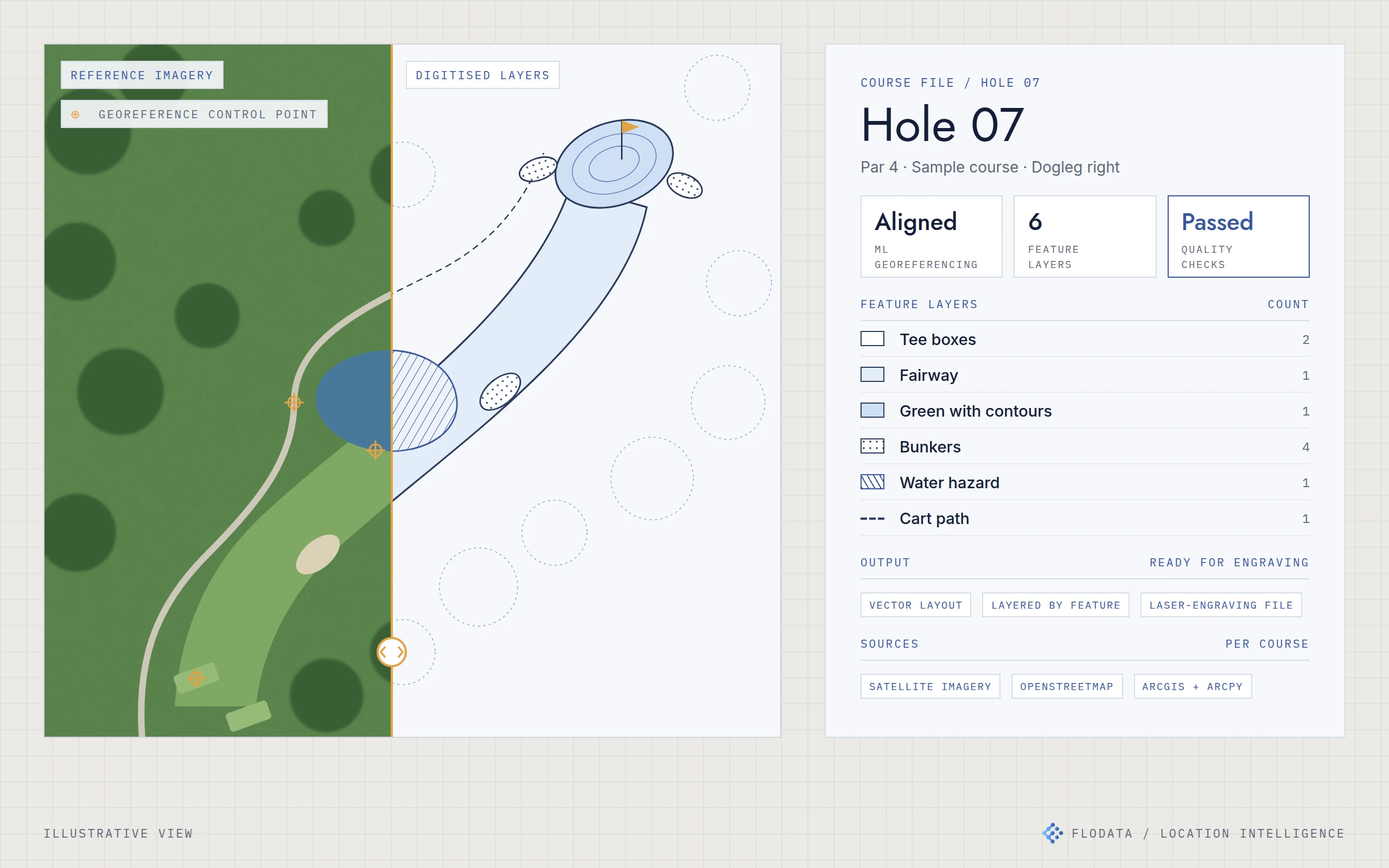
Course maps for a US map publisher, digitised feature by feature and ready for laser engraving, in less time and at lower cost per course.
ML georeferencing · ArcGIS and ArcPy · Python automation · OpenStreetMap and satellite imagery · Feature-level QA