01Frame
Name the decision before opening the dataset.
We establish what someone needs to decide, what they know today and what prevents them from acting.
A decision worth solving for.
DATA, AI & LOCATION INTELLIGENCE
Whether your data lives in paper files or live systems, we engineer what turns it into your next decision. We start by finding what is stopping it.
Projects delivered
Countries served from New Delhi
Products developed
01 / HOW WE THINK
The problem sets the direction.
Every recommendation comes with evidence you can examine.
The problem determines what we build.
We untangle messy, conflicting data before we build on it.
We build systems your team can keep improving.
02 / WHAT WE DO
Six services. Shaped around your problem.
Connect scattered records and automate the re-keying, checks and handoffs around them.
02Generative, perception and predictive AI solutions built around your data and operating rules. Deployed in the cloud, on your servers or fully offline where required.
03Map your assets, customers and demand together to see where to invest, expand or intervene.
04Make forecasts and dashboards that answer a specific business question.
05Move legacy systems, spreadsheets and paper records onto usable platforms while preserving their history.
06Keep the systems we build monitored, maintained and improving.
03 / THE WHOLE CHAIN
From raw records to a decision
Paper · Spreadsheets · ERPs
Sensors · Satellite · Maps
Extract · Reconcile · Link
Apps · APIs · Assistants
Dashboards · Maps
04 / THE FLODATA METHOD
Diagnosis before prescription.
We establish what someone needs to decide, what they know today and what prevents them from acting.
A decision worth solving for.We inspect actual records and follow the workflow with the people responsible for it. The diagnostic exposes missing information and practical constraints.
A clear picture of the real constraints.We recommend an approach that fits the problem, including reusing existing systems or reducing the scope.
A scope that earns its place.We engineer the required data flows and interfaces. Bespoke development runs through every service.
The engineering follows the evidence.We monitor what is running and extend it as operational needs develop. We stay well after delivery, with support commitments shaped around your long-term economics.
A system that keeps working as things change.05 / SELECTED WORK

Scanned property files became a linked register, with every ownership change traced to its source and every plot on the map.
OCR and document classification · Two-pass AI extraction with validation · Chain-of-title register · Web map with plot polygons · Maker, checker and approver workflows
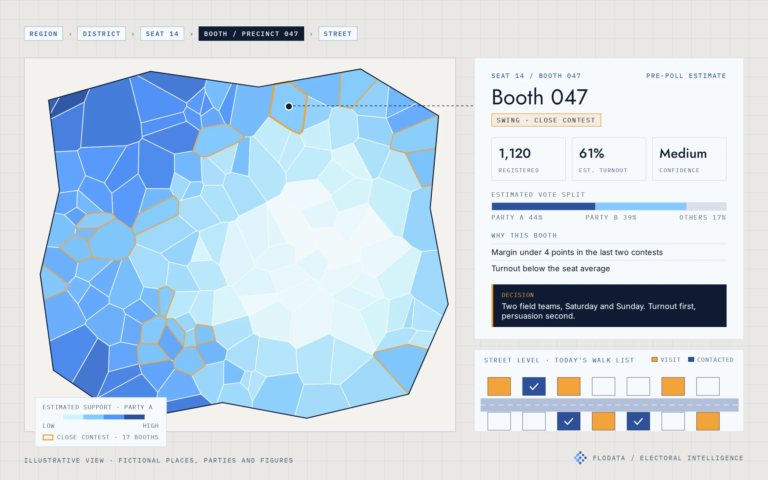
Electoral intelligence for a US campaign and an Indian party organisation. Estimates built from official results, mapped from the seat to the street.
Official results and electoral rolls from public sources · Booth reconciliation across elections · Segment-level turnout and preference model · Bottom-up aggregation with confidence levels · Web maps from region to household · Prediction service with Excel-ready exports · Web dashboard and mobile field app
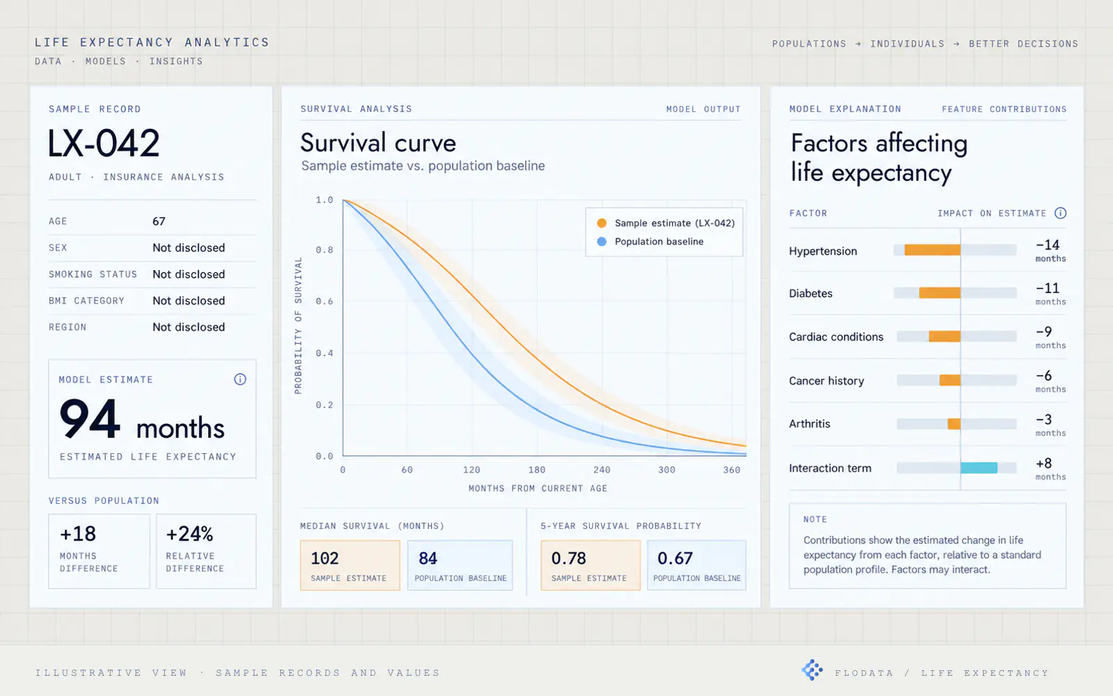
Medical records became a structured, explainable input to life-settlement valuation.
OCR and document classification · NLP-based medical factor extraction · Standardised medical and lifestyle factor set · Cox Proportional Hazards survival model · Baseline and factor-contribution dashboard · Benchmark comparison against industry and internal methods
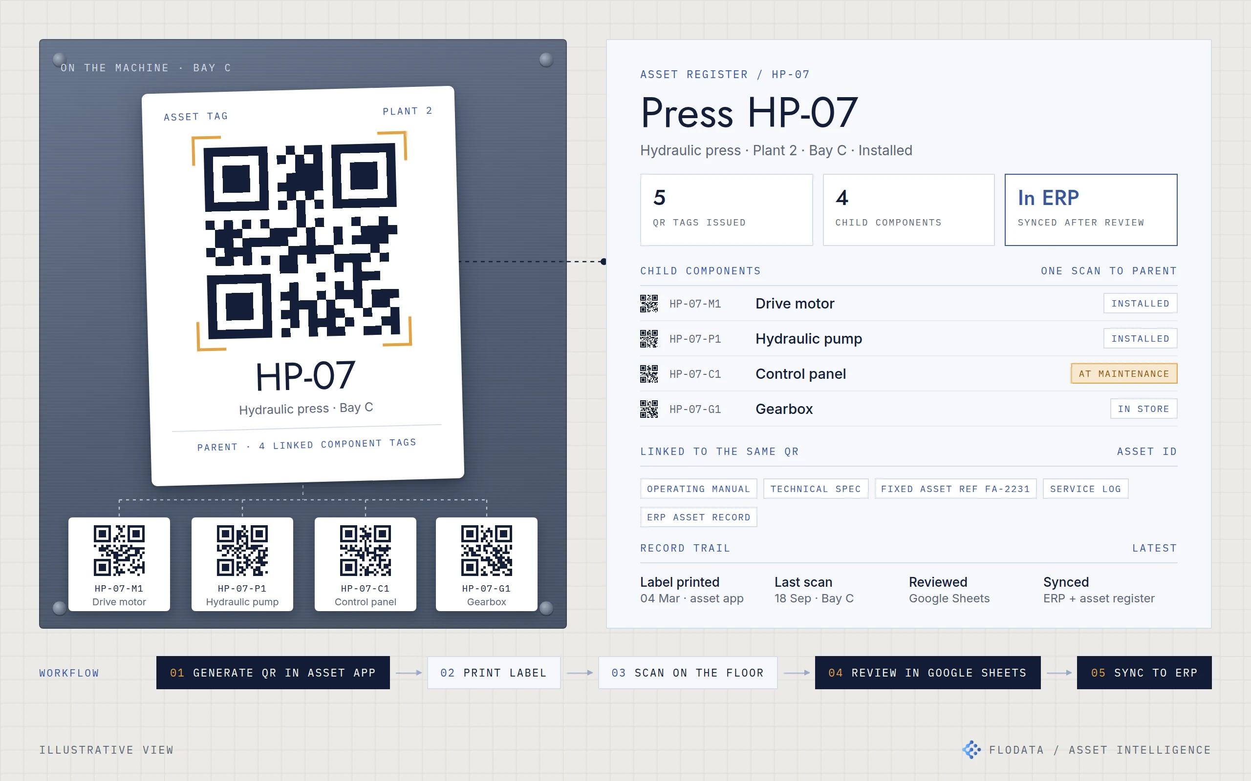
A simple asset-control layer gave mixed-generation plants one way to find, verify and service their machinery, without waiting on the ERP.
Asset app with QR generation and label printing · Mobile stocktake app · Parent and child asset structure · Google Sheets review workflow · ERP and fixed asset register integration
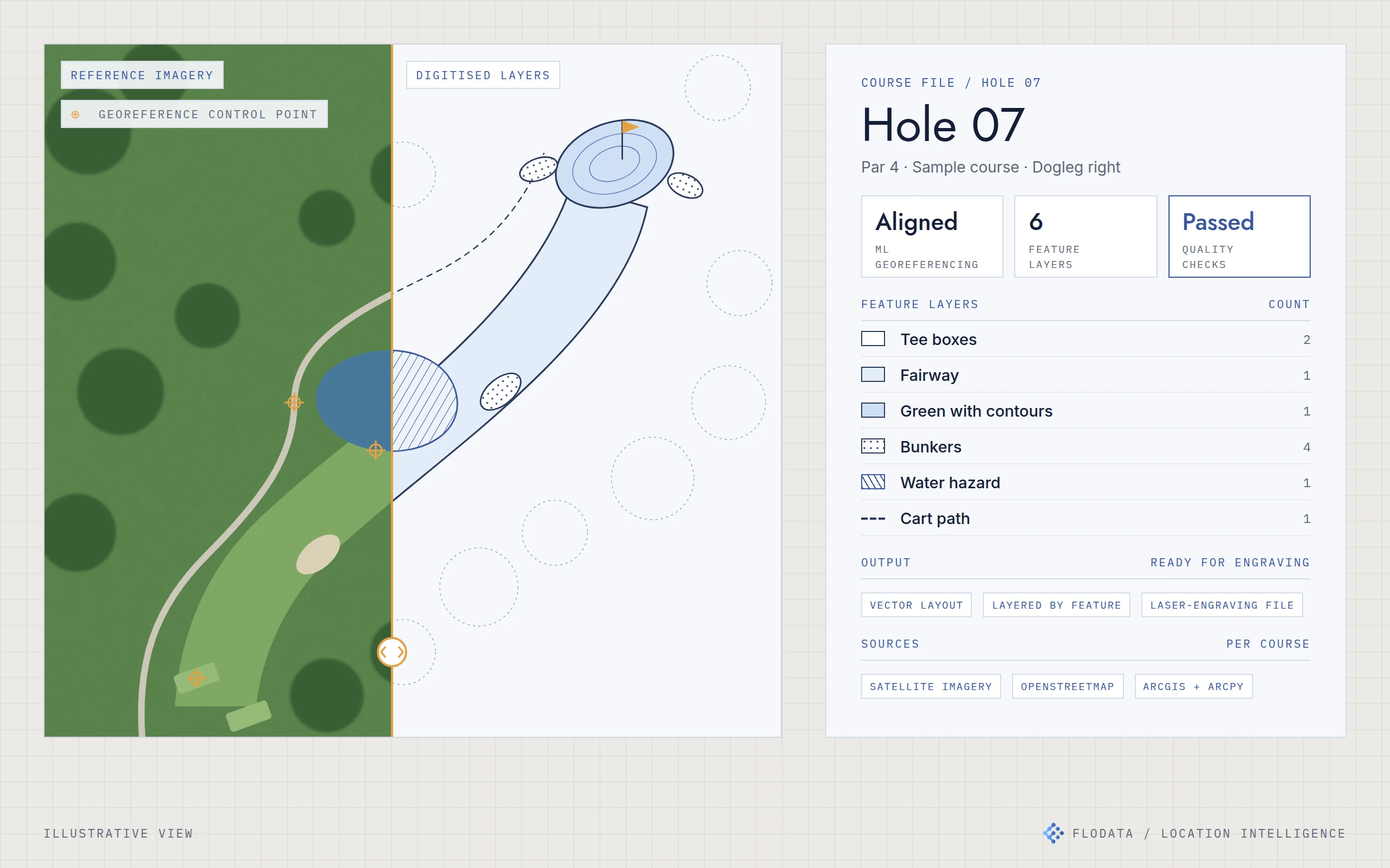
Course maps for a US map publisher, digitised feature by feature and ready for laser engraving, in less time and at lower cost per course.
ML georeferencing · ArcGIS and ArcPy · Python automation · OpenStreetMap and satellite imagery · Feature-level QA
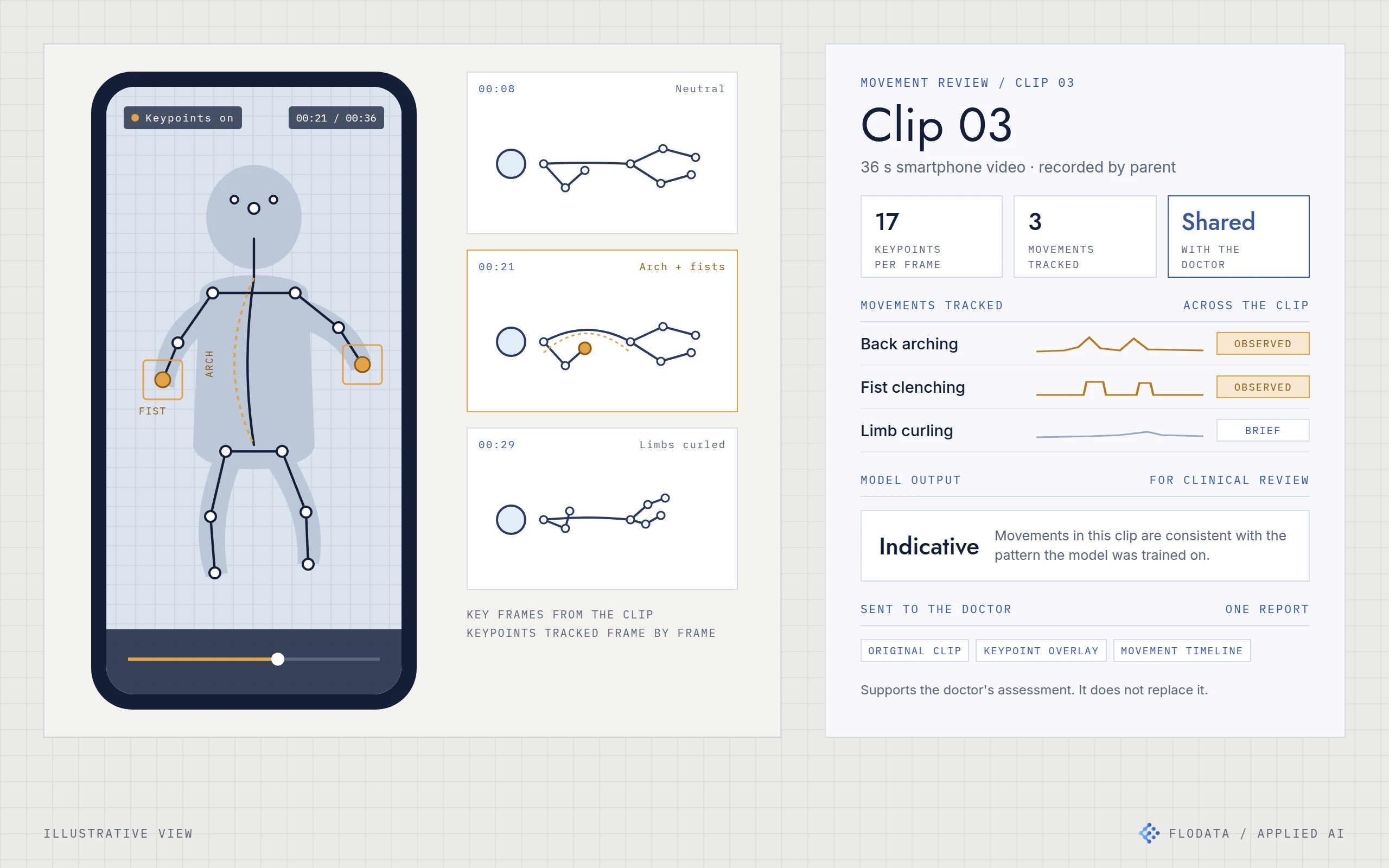
Smartphone videos of children became a measured movement record, so parents and doctors could discuss what they saw with something objective in front of them.
Pose estimation · Keypoint detection · Movement signal extraction · Trained classifier · Clinician-facing report
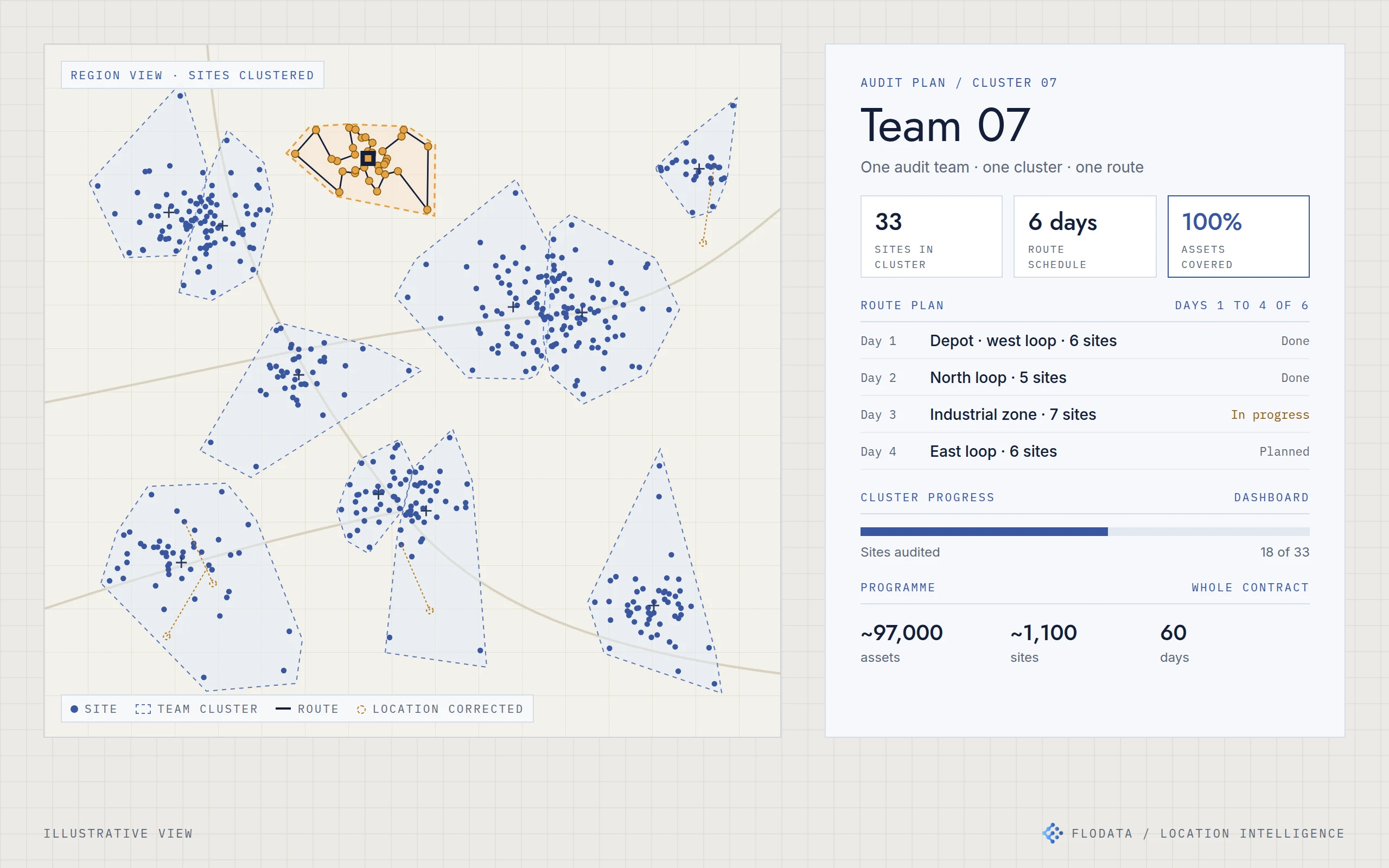
A facility maintenance provider planned an audit of about 97,000 assets across 1,100 sites in 60 days, with about 35% fewer teams than it first estimated.
QGIS spatial cleaning · K-means clustering in Python · Route planning · ArcGIS dashboard
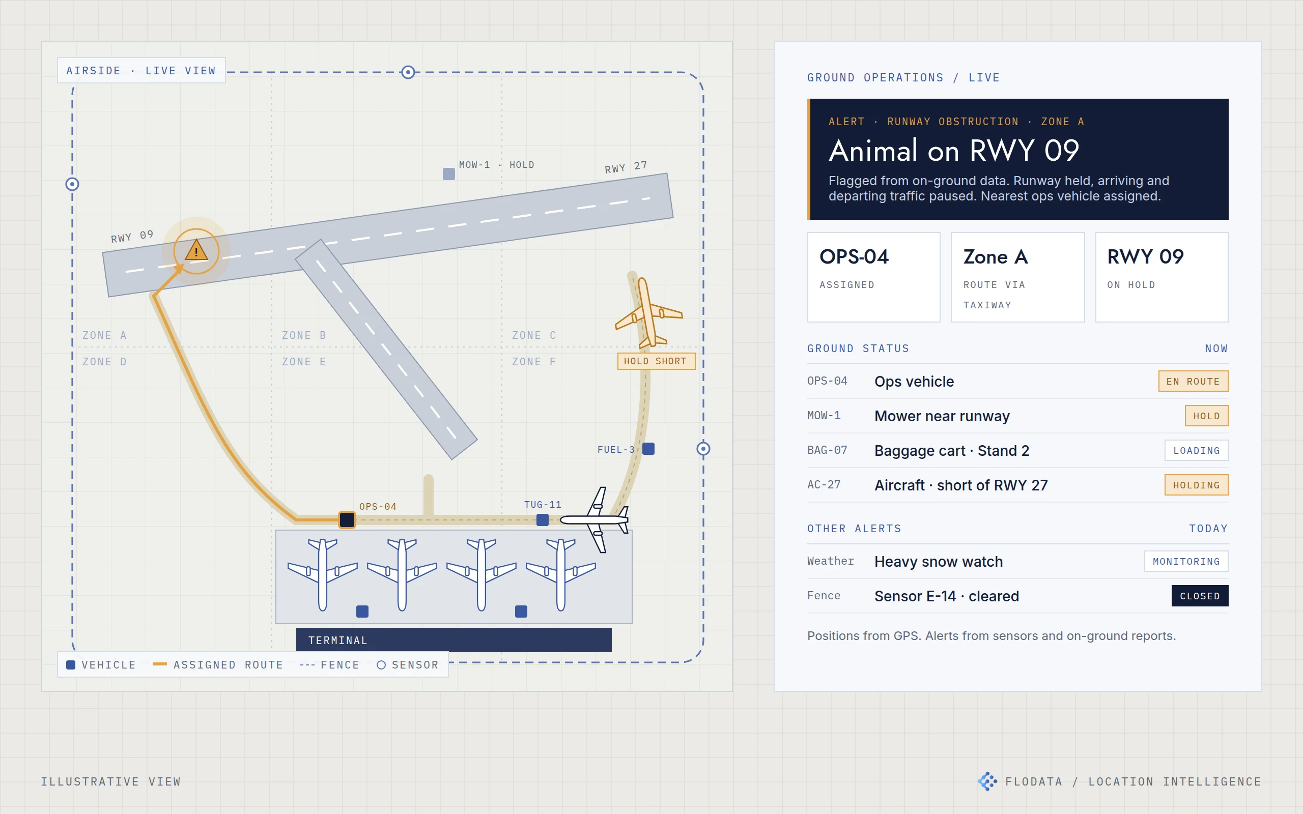
Ground teams at several US airports moved from radio calls to a shared live map of vehicles, luggage and incidents.
GPS vehicle tracking · Sensor integration · Live airside map · Location-based alerting · Zone-based routing
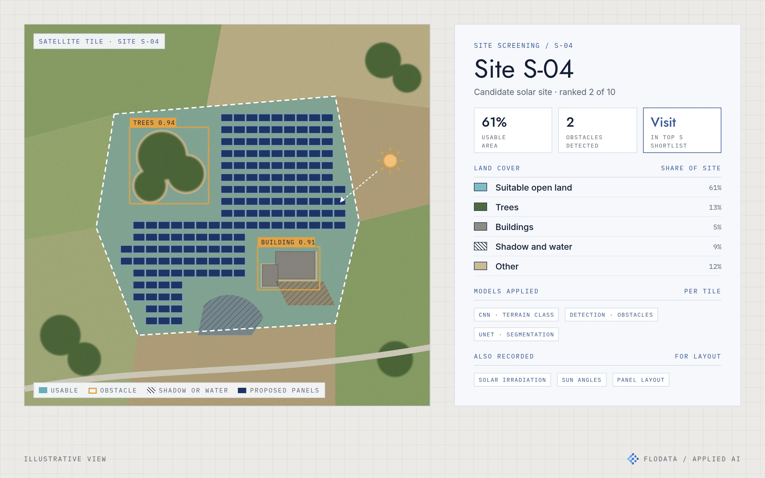
Satellite imagery screened candidate solar sites before anyone travelled, so only the top five of ten needed a visit.
CNN terrain classification · YOLO and Faster R-CNN detection · UNet segmentation · Irradiation and sun angle data · Drone inspection integration
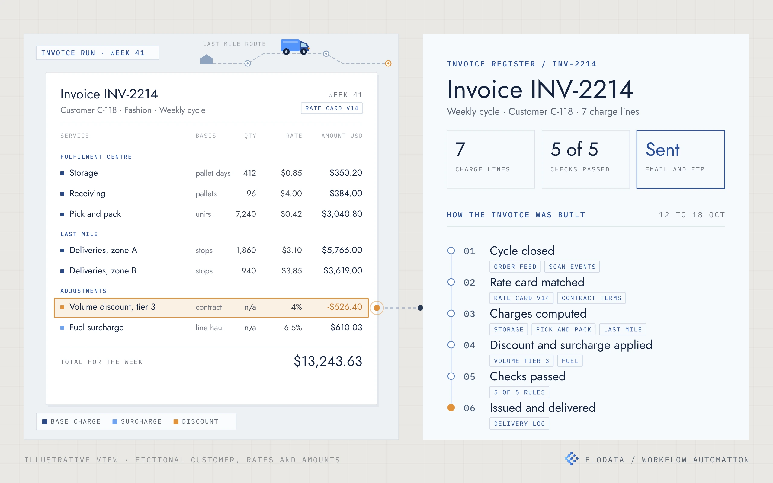
A fulfilment and last mile provider's weekly invoicing now runs from its own data, with every rate, discount and surcharge applied and checked before anything is sent.
PostgreSQL data store · Python computation · Cloud workflow automation · Rule-based invoice checks · Per-customer invoice formats · Scheduled delivery by email, FTP or file upload
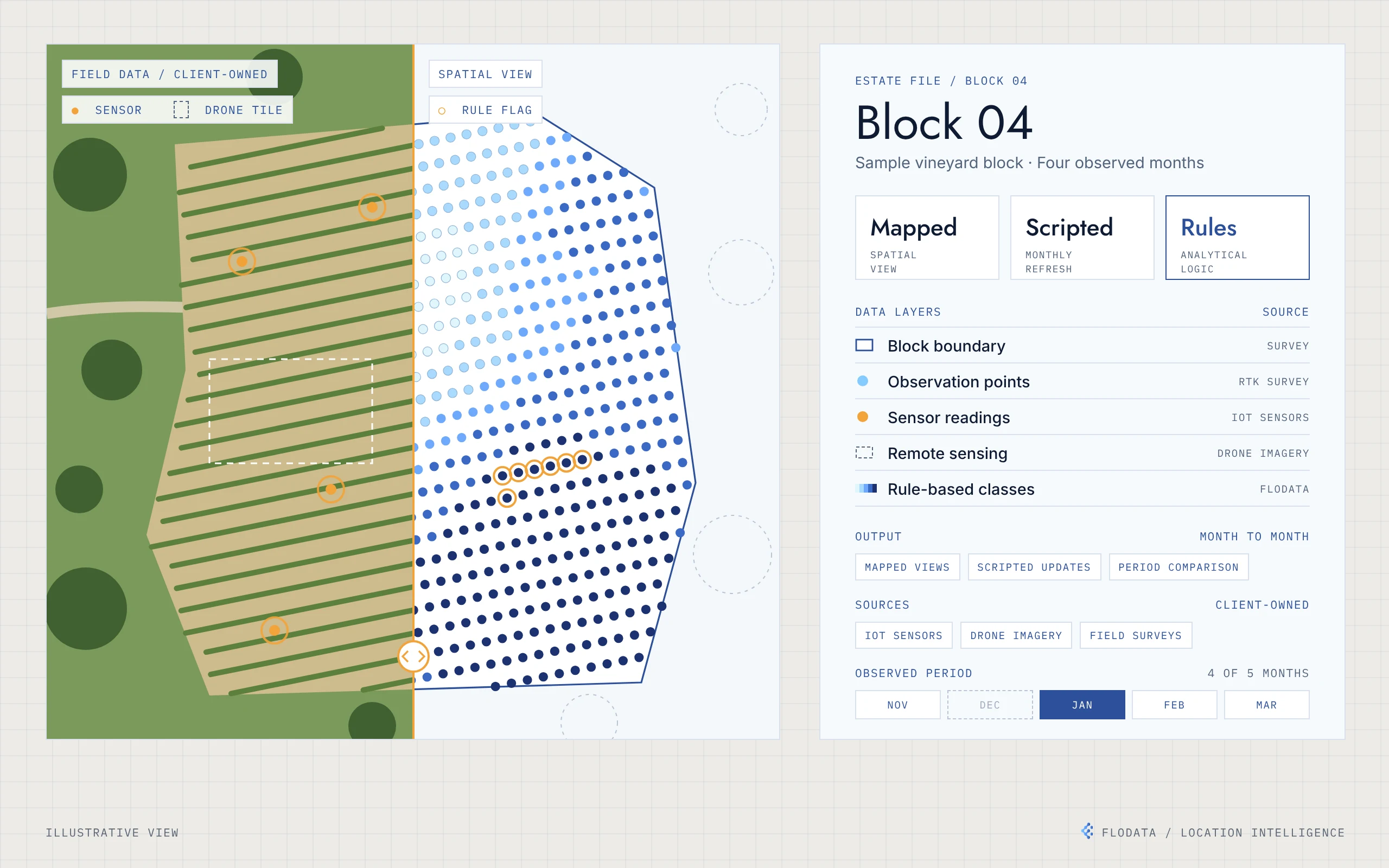
A vineyard's sensor, imagery and survey data, mapped across the estate and compared month by month.
Desktop GIS mapping · Python automation · Rule-based classification · RTK-referenced points · IoT, drone and survey inputs
06 / HOW WE START
Start with what is getting in the way.